By: Richard L. Smith
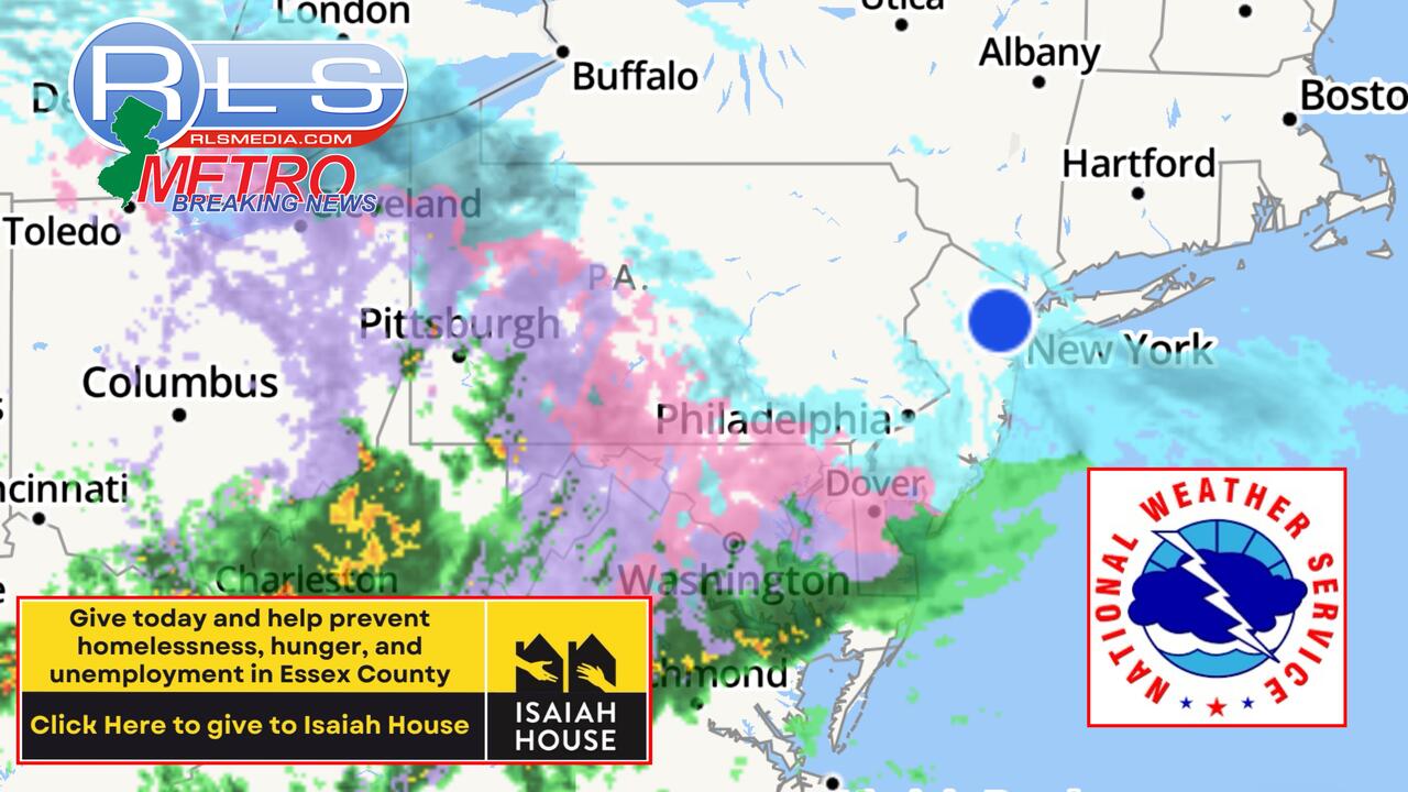
A powerful storm system is marching across the country, bringing a messy mix of snow, freezing rain, and potential flooding to Newark and the North Jersey region today. 
As residents wake up to freezing temperatures at 30 degrees this morning, the storm is making its way from Pennsylvania and is expected to create hazardous road conditions throughout the area.
With widespread snowfall expected to drop between 1 to 3 inches, slippery roads, and reduced visibility will likely cause significant travel disruptions.
The wintry mix is forecasted to begin around 6:30 a.m., prompting hundreds of school delays and closures across North Jersey.
Commuters should be prepared for dangerous road conditions as precipitation will continue through late morning, with snow and sleet turning into freezing rain before transitioning to all rain in the afternoon.
According to the National Weather Service, today's forecast includes snow and sleet, possibly mixed with freezing rain until 10 a.m., followed by rain, freezing rain, and sleet between 10 a.m. and noon.
By the afternoon, precipitation will shift to rain with patchy fog and a high near 38 degrees. Wind chill values will remain between 25 and 35 degrees.

Tonight, conditions will remain mostly cloudy, with a low of around 35 degrees.
Drivers are urged to exercise caution, plan extra travel time, and stay updated on weather advisories. Be safe, New Jersey, and stay warm as this storm marches through!